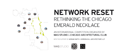
Before the expressways, there were the boulevards. They were created in the last decades of the 19th century both in the easternmost sectors of Chicago, and along the city's then western borders, connecting a sequence of spectacular new parks. The boulevards were Chicago's attempt to create suburbs within the city, a refuge for the wealthy, who lined them with their mansions. They were an early example of a successful public-private partnership. Built by the Parks Commission, the boulevards made a lot of developers rich, created a wave of new construction, and expanded the city's tax base.
click images for larger view
Over time, mansions were replaced by luxury apartment buildings. As the rich fled to the suburbs, the middle-class took over, and when the middle-class fled, the sturdy old structures were often appropriated by slumlords. What were leisurely carriage drives became, with the coming of the automobile, express routes out of the city With the opening of the expressways, even that purpose was taken away. The grand old houses were left to decay or, in times of rage, burned to the ground, leaving what were once considered among Chicago's most prized civic assets littered with boarded-up buildings and vacant lots. No new boulevards were created. As the city stretched to its final borders, it just bled almost imperceptibly into the adjacent suburbs, with occasional strips of forest preserve as insulation.What should be the role of our boulevards in 21st Century Chicago?
That's the subject of a new competition, Network Reset: Rethinking the Chicago Emerald Necklace, an international competition organized by MAS Studio and the Chicago Architectural Club, funded with a grant from compulsive urban tinkerers Adrian Smith + Gordon Gill Architecture LLP.
A few years ago, UrbanLab came up with its own concept of the "Eco-Boulevard" that created a new vision that combined social, environmental and energy conservation considerations. Network Reset, in contrast, "seeks to provide ideas and actions that can reactivate the Boulevard System of Chicago and rethink its potential role in the city . . .
While portions of it, such as the Logan Square Boulevards District (an official city landmark district since 2005) still maintain the original character, other parts have just become underutilized areas and oversized streets that act as barriers within neighborhoods.The competition launched on January 17th. The Q&A period runs through February 4th, with a February 21st deadline for submissions, and a March 14th announcement of winners: a $2,000 first prize, $1,000 second, and $500 third. Check out the Network Reset website for more detailed information.
That is where we are now and this competition asks you to envision where we can be in the near future. These are some of the questions that we are asking ourselves and we want you to think about in your proposal: What if the system becomes a new transportation corridor in the city? What type of transportation would that be? What if the open space becomes an active layer and not just a passive one? What if this system provides activities that the city as a whole is lacking? What if the system becomes a tool for social cohesion? What if the system has a strong visual identity? What if it becomes an economic catalyst for the neighborhoods? What if the system is all of this and more?
Participants are asked to look at the urban scale and propose a framework for the entire boulevard system as well as provide answers and visualize the interventions at a smaller scale that can directly impact its potential users. Through images, diagrams and drawings we want to know what are those soft or hard, big or small, temporary or permanent interventions that can reactivate and reset the Boulevard System of Chicago.
I think my favorite of all the boulevards is Drexel, once described as the gem of the boulevard system.
It's width two hundred feet, the original design comprised a central ornamental space, one hundred feet wide, arranged with paths and with grass-plats, planted with trees and shrubbery, a driveway running on each side.According to the Waymarking.com website, it was the creation of the father of the Drexel brothers of Philadelphia, who acquired the 80 acres from 47th to 51st through foreclosure, and donated the plot to the park district. His sons would profit from the now highly valued real estate development along the boulevard, and his sons memorialized him with what has been called Chicago's earliest public fountain, at the south end of the Boulevard at 51st street, where the figure of Francis Martin Drexel, as sculpted by Henry Manger, still holds watch over creation. Like Michael Reese, there is no record that he ever visited the city where he played so vital a role.
Our recent years of relative prosperity have seen the revitalization of much of Drexel Boulevard, with old mansions restored for affluent new owners, and new construction interposed where empty lots once stood. You can see works by Burnham & Root, Frost & Granger, and Henry Ives Cobb in something approaching their original splendor, and get a sense of the kind of grandeur and uplift the boulevards can provide.
In 2006, in preparation for writing a paper, "ink" biked the entire 28 mile system, taking photographs all along the way. The result is a rather splendid photo-essay. Check it out here.


3 comments:
I hadn't seen this yet. I used to work at AS+GG and I worked on a similar project at Archeworks. I might have to see if I can find time to develop something.
very good
Start by restriping the entire boulevard system to create bike lanes.
Post a Comment